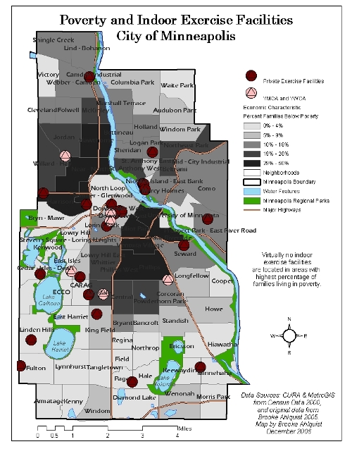
For my Master’s thesis in the Department of Geography at the University of Minnesota and with the help of an Independent Research Grant from the Improve Group, I conducted a study on the accessibility of healthy amenities, primarily healthy food, in the city of Minneapolis. This study examined one aspect of how the built environment can potentially impact health. I mapped the amenities against different neighborhood demographic, economic, and crime characteristics. The maps reveal significant disparities in access to several of the healthy amenities (healthy food, large grocery stores, exercise facilities, and large parks) for neighborhoods that are predominantly minority, have low socioeconomic indicators, and high rates of violent crime. For example, this particular map depicts the near dearth of exercise facilities for south central and North Minneapolis especially when compared to southwest Minneapolis. These patterns can be found in large urban areas across the United States.
While the findings are meaningful on their own, I have decided to take the study one step further. I have acquired Hennepin County SHAPE survey data which details health indicators of the county’s residents. I plan to conduct a spatial and statistical analysis of my findings from my previous research and lifestyle-related health indicators such as Body Mass Index, diet, level of physical activity, and prevalence of type 2 diabetes for Minneapolis residents. As I move forward with my research, I have learned that obesity and diet related illnesses are complex and identifying causal relationships is very difficult. However, due to persistent racial and economic segregation in large urban areas, including Minneapolis, understanding how access to healthy amenities can potentially impact health is critical.


